April 2012, Vol. 239 No. 4
Features
Modern Tools Help You Precisely Know Your Field Assets

Several concurrent forces are at work today at the operational, production and regulatory compliance levels that are creating an urgent need for enhanced tools to help operators meet all of today’s ever-increasing asset management requirements. At the same time, operators are striving to gain improvements in operational efficiency to increase production with fewer staff, and do so in a manner that fully satisfies the regulatory requirements. Fortunately, there are many practical advances in both foundational and emerging technologies that can help operators address all these converging forces.
Operators need to be cognizant of the increased challenges, but should also recognize that today’s technology can provide real solutions to help convert challenges into opportunities.
One of the significant changes affecting all aspects of energy production today in the U.S. is the heightened sensitivity of pipeline accidents. Media attention surrounding the September 2010 San Bruno, CA pipeline explosion was unprecedented for such an event, as news organizations found they could attract more viewers or readers by raising the specter of human and/or environmental disaster. Since then, with a public sensitized to such problems, a pipeline leak or oil spill of almost any size immediately attracts media attention. Furthermore, the media may not be averse to projecting a doomsday scenario, or to treating the operator with prejudice.
Because administrative agencies are influenced by public opinion, the recent accidents have also contributed to an increase in asset-management regulations. Every U.S. operator is well aware of the increased time, effort and expense, as they struggle to meet all of the requirements. However, it is also clear that the safety and efficiency of the industry has greatly increased since these new regulations were initiated.
Operators can now expect another significant round of regulations and asset-reporting requirements with particular focus on gathering systems which, heretofore, were largely spared such attention. Operators are grappling with how they will comply with the new regulations, what the changes mean for them, and what changes will they need to make. What is clear is that the new regulations will require more comprehensive and current data on all pipeline assets.
Noteworthy also is the vintage of our pipeline infrastructure. A significant number of the pipelines in the U.S. were installed 50 or more years ago. At the time of construction, regulatory requirements were far fewer and less restrictive than they are today. Many of these lines and aging assets were installed in areas that were open land, but now border on the urban interface and hence must be managed to a set of more stringent regulations.
The impact of all these issues is that operators today have an ever-increasing burden to ensure they meet all the regulatory requirements for asset management. Operators will also encounter far greater challenges should they fail in their compliance endeavors. Any type of incident is highly likely not only to incite media attention, but to be extremely expensive to correct, far more expensive than in times past.
By far the most cost-effective solution for operators is to proactively ensure they are meeting all regulatory requirements. The degree of exposure is simply too great to avoid taking all reasonable measures to mitigate the risk. To do this, operators must have current and accurate asset information available in order to develop effective, sustainable management plans. They must know what they have in the ground and its current status. They must be able to show evidence that their asset-management system accurately represents the reality in the field. Finally, the asset data must be easily accessible to all the stakeholders, including the field teams that originally collected the data.
It should also be noted that most operators at some point, knowing that they needed better field-asset information, have made attempts to implement process and technological improvements. These efforts were not always successful. Oftentimes, the costs were prohibitive, as the field teams struggled to collect and then transfer the asset data.
Sometimes, the collected data was sent up the line, only to have it disappear into a “black hole” where it was difficult to access or simply not available to those who needed it. Essentially, the technology employed was slow and difficult to implement and companies did not always get the hoped-for value from the asset-management system. However, new technology has emerged and existing technology has matured so that the types of tools discussed here can be implemented with greater ease, and used with higher confidence, to manage the necessary data and reap the benefits of the asset management system.
There are three key components to solving the problem of confidently knowing what is in the ground and being able to utilize that information. First, asset data in the field must be easily collectable in a standardized format which is used throughout the organization. Second, asset information must flow easily and swiftly from the data collector in the field to the office and the organization headquarters. This means the data transfer must be automated if the information is to be kept current.

Finally, it is an absolute requirement that the data be easily and quickly accessible across the organization by all the information consumers – engineering, GIS, environmental health and safety, regulatory affairs, operations, and also by the field teams themselves. After all, it will not help a field person who is being asked for pipeline data by an official inspector, if the collected information is siloed at the district level and inaccessible.
Nor will it suffice to provide only one or two of these components because the old adage of a chain being only as strong as its weakest link definitely applies when regulatory issues are involved. The proper answer is a completely integrated solution that addresses each of these needs individually and then ties them together.
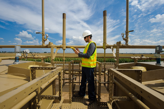
Beginning with the field component, data-collection technology has improved and is now very viable and easy to use. Mobile devices can collect highly accurate spatial data which will speed up the data collection process while improving its accuracy and integrity. This also provides more efficient and better field-decision support.
As a useful tool, the mobile device needs to closely support the organization’s inventory processes and provide some level of automation in addressing field-data collection. Pre-configured forms and workflows on mobile devices make the field person’s job go faster, with fewer errors. Structured data collection in the organization’s standardized format, with the field teams all employing the same, consistent workflow, markedly improves the information transfer process and ultimate usability of that data. All of this translates to an enormous boost in productivity for the field teams.
The next step in the process is the timely transfer of data from the field to the offices and ultimately the information consumers. If the data is collected using standardized forms and workflow, then solutions can automatically upload the data to the servers, eliminating redundant procedures and saving hours of data entry. The data flow, including supporting documentation, is streamlined to the local office and headquarters.
Servers using the speed and accessibility of the Internet provide centralized processing of the data and make it available where it is needed. Of great significance is the display of information in a map context – a spatial view of the data – and not just tabular columns of numbers. This means that stakeholders anywhere are now empowered to really know, with near real-time certainty, “These are my assets. This is what I have. And this is how I need to manage them.”
This level of high-quality information is actionable. At audit time, the headquarters office will have the supporting documents to verify that the asset really is what and precisely where the records indicate. In case of an incident, management will know immediately the extent of the problem and what actions are necessary to address it. This type of information can also allow companies to proactively identify the areas of greatest exposure, dispatch teams to verify asset data and, if need be, take action to mitigate the exposure.
Today’s solutions are practical. The technology improvements in mobile devices include easily configurable workflows, high-accuracy GPS data gathering and automated data transfer. On the server side, stakeholders can now store, display, interact, report and analyze the data with easy access Web interfaces. This means that even small operators can implement powerful integrated solutions without incurring prohibitive costs.
Many companies are often averse to long-term development projects because of difficult or unsuccessful experiences in the past. They wish to avoid custom software projects which are expensive and often take time to realize a return-on-investment. The answer in many cases is to start with focused, quick-to-implement, solutions that follow industry standards and produce rapid results. This approach also serves as a springboard to jump start the development of a fully integrated spatial asset-management system.
What operators must understand before upgrading their systems and processes is that, for a company to realize the enormous potential of an asset-management system, there must be a management commitment to the program. This high-level commitment takes the form of long-term planning encompassing all stakeholders, with measurable success factors and accountability and – of course – funding. But if a company will make this commitment, they will have a solid foundation from which to more easily respond to industry and regulatory changes.
A fully integrated spatial-asset management system means that people have better access to the information they need, when they need it, so they can do their jobs more efficiently with greater productivity. That is not a pipe dream but rather what today’s leading-edge technology companies deliver.
Author
Glenn Vlass has worked as an exploration geologist performing field surveys in Colorado, Wyoming and Alaska. He joined CartoPac in 2000. He graduated from Western State College with degrees in Geology and Business Administration.


Comments